

Most travellers know the Dades Valley as a night’s stop between Marrakech and the Sahara. They arrive at dusk, leave after breakfast and remember a river, some strange rocks and a road with many bends. It deserves better. For sixty kilometres the Dades runs between walls of red and violet rock, and along its banks stand some of the loveliest earthen villages in Morocco, each with its kasbahs, its gardens and its own way of catching the light. This is a guide to the ones worth slowing down for.
01Understanding the Valley
The Dades rises high in the central Atlas, above 3,000 metres, and flows south and then west to join the Draa near Ouarzazate. The part travellers call the Dades Valley lies between the town of Boumalne Dades, on the main road from Ouarzazate to Tinghir, and the village of Msemrir, about sixty kilometres upstream. A paved road follows the river all the way.
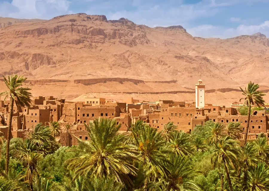
The pattern is always the same, and it is what makes the valley so photogenic. At the bottom, the river and a narrow band of gardens: wheat, barley, alfalfa, and trees of fig, almond, walnut, apple and poplar, divided by low walls and watered by small channels. Just above the flood line, the villages, built of the same earth as the hillside. Above them, bare rock in bands of red, pink, mauve and green.
The people of the valley are Amazigh, mostly of the Aït Atta and Aït Seddrate groups, and Tamazight is the language of every home. Their houses are built of pisé, earth rammed between wooden boards, and the great fortified houses, the kasbahs, carry geometric patterns in mud brick on their upper towers.
02Boumalne Dades: The Gateway
Boumalne is a working market town set on a plateau above the river, at about 1,500 metres. It is not a village and nobody would call it beautiful, but it earns its place on this list for two reasons. The first is the view from its upper edge: the whole lower valley lies below you, a long green band between dry hills, with the snow of the M’Goun massif behind in winter and spring.
The second is its Wednesday souk. Farmers and herders come down from the whole region to sell sheep, vegetables, dates and spices, to have tools mended and to exchange news. There is nothing staged about it. Boumalne is also where you find the last bank machines, pharmacies and fuel before heading into the gorge.
South of the town, a track leads to the stony plain called the Valley of Birds, which attracts birdwatchers looking for desert species such as sandgrouse, larks and wheatears.

03Aït Youl and Aït Arbi: The Kasbah Villages
A few kilometres upstream the valley narrows and the first great kasbahs appear. At Aït Youl, tall earthen towers stand directly above the gardens, some restored and lived in, others slowly returning to the soil. The best view is from the road in the late afternoon, when the sun is behind you and the walls turn the colour of copper.
Aït Arbi, a little further on, is perhaps the most painted and photographed spot in the lower valley. Here a group of kasbahs stands at the foot of a wall of deeply eroded red rock, so that buildings and cliff seem to be made by the same hand. Leave the car and walk down into the gardens. Paths run beside the irrigation channels, women carry bundles of fodder home on their backs, and children wave from the roofs. A footbridge crosses the river, and from the far bank the village is reflected in the water.
These kasbahs once belonged to powerful families who controlled the passage of the valley. Building in earth is cool in summer and warm in winter, but it needs repair after every heavy rain, and many families have moved to concrete houses beside the road. Staying in a restored kasbah guesthouse helps to keep the old houses standing.
04Tamellalt and the Monkey Fingers
Around fifteen kilometres from Boumalne, on the far side of the river from the road, an entire hillside has been carved into rounded columns and knuckles of rock, pressed against one another like the toes of a giant. The locals call them the “monkey fingers”, sometimes the “brain of the Atlas”. They are made of conglomerate, pebbles cemented together and sculpted by water over an immense span of time.
Below them lies the village of Tamellalt, whose houses are the same colour as the rock. From the gardens a path enters a narrow canyon that winds between the formations, sometimes barely wider than your shoulders. It is an easy and memorable walk of one to two hours, best done with a local guide who knows the way through and can explain the plants and the irrigation system on the way back through the fields.
Come in the late afternoon. The low sun gives depth to every fold in the rock, and the terraces of the guesthouses opposite are the perfect place to watch the colour change with a glass of tea.
In the Dades, the best moments are on foot: ten minutes from the road, the valley belongs to the people who farm it.
05Aït Oudinar and the Gorge
Beyond Tamellalt the valley closes in. At Aït Oudinar a bridge crosses the river, and several of the most pleasant guesthouses in the Dades stand here, with terraces directly above the water. It is a good base for walkers: paths lead up side valleys to seasonal nomad camps and across to the neighbouring plateau.
A little further, the road enters the gorge proper. The cliffs rise to several hundred metres and the river fills almost the whole floor. In spring it runs the colour of milk chocolate with snowmelt; by late summer it is clear and shallow enough for children to paddle.
06The Tisdrine Bends
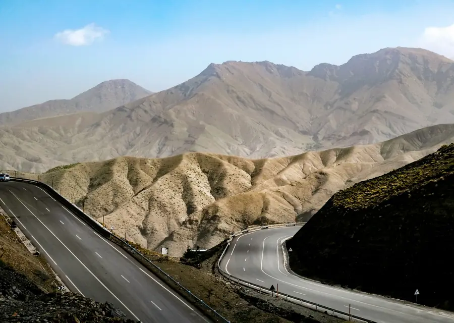
About thirty kilometres from Boumalne the road leaves the river and climbs the wall of the gorge in a tight stack of hairpin bends, one above the other. This is the image of the Dades that everyone has seen: a grey ribbon folded back on itself between red cliffs. At the top, a café terrace looks straight down on it.
The road is paved and perfectly safe when driven slowly, but it is narrow, and it is more comfortable in the hands of a driver who knows it. Photographers should come early in the morning, when the bends are in sun and the opposite cliff is in shade. Just beyond the top, the river squeezes through a slot in the rock only a few metres wide.
07Msemrir: The Upper Valley
Few visitors continue beyond the bends, and that is the reason to do it. The upper valley is wider, higher and wilder. Villages are smaller, the fields grow potatoes and apples, and in summer the slopes are dotted with the black tents of Aït Atta nomads who bring their flocks up from the Saghro.
Msemrir, at nearly 2,000 metres, is the main village of the upper valley and holds a lively souk on Saturdays. Beyond it, pistes climb toward the high plateau of Imilchil and across to the top of the Todra Gorge, journeys for a 4x4 and a full day in good weather. If you have a spare half day in the Dades, the drive to Msemrir and back shows a side of the valley that most people never see.
08The Valley of Roses
West of Boumalne, the M’Goun river joins the Dades at Kalaat M’Gouna. This is the Valley of Roses. The Damask rose is grown here not in fields but as hedges between the plots of wheat, and for three or four weeks in spring, usually from late April, the petals are picked at dawn before the sun can take their perfume. They are sold fresh to the distilleries of the town, which turn them into rose water and oil, or dried for sale in the souks.
In May, when the harvest ends, Kalaat M’Gouna celebrates with a festival of music, dance and a parade. Outside that season you will not see flowers, but the valley is beautiful at any time. Drive north from the town to the villages of Hdida and Bou Tharar, where kasbahs stand above the river and paths lead from hamlet to hamlet through the gardens. Local cooperatives sell rose water, soap and cream; buying from them supports the women who do the picking.

09Practical Advice for Visiting
How to make the most of the valley:
- Give it timeArrive by mid-afternoon rather than at nightfall, or stay two nights. A full day lets you walk at Tamellalt, drive to the bends and beyond, and still be back for sunset.
- Walk with a local guidePaths through the gardens cross private plots and irrigation channels. A guide from the village knows the way and adds a great deal.
- Best seasonsApril and May for green fields, blossom and roses; September and October for harvest colours. Winter is cold, bright and very quiet.
- What to wearSturdy shoes that can get wet, a sun hat and a warm layer. At 1,500 to 2,000 metres, evenings are cool even in summer.
- Respect daily lifeAsk before photographing people, especially women working in the fields, and keep to the paths between crops.
- CashWithdraw money in Boumalne or Kalaat M’Gouna. Guesthouses in the gorge often cannot take cards.
10A Suggested Day in the Valley
If you can give the Dades a full day, this is how we would spend it. After breakfast on the terrace, drive up the gorge while the bends are in morning light and continue for half an hour into the upper valley, stopping wherever a village or a view asks for it. Turn back before Msemrir, or go all the way on a Saturday for the market.
Return to Aït Oudinar for lunch beside the river. In the afternoon, meet a local guide at Tamellalt and walk through the gardens and the canyon of the monkey fingers, coming out above the village as the sun drops. End the day at Aït Arbi, when the kasbahs glow against the cliff, and be back at your guesthouse in time for dinner by the fire. It is an unhurried day with little driving, and for many of our guests it becomes a favourite of the whole journey.
11Dades Valley: Frequently Asked Questions
Where is the Dades Valley?
In southern Morocco, between Ouarzazate and Tinghir, on the southern side of the High Atlas. Boumalne Dades is about 115 kilometres east of Ouarzazate.
How long should I spend in the Dades Valley?
One night is the minimum on a desert tour. Two nights give you a full day for walking and for the upper valley.
What is the difference between the Dades and Todra gorges?
The Dades is a long valley of villages, gardens and rock formations. The Todra, an hour to the east, is a short, dramatic canyon with cliffs about three hundred metres high. Most itineraries include both.
When do the roses bloom?
Usually from late April to mid-May, depending on the weather. The festival in Kalaat M’Gouna takes place in May.