Culture
A Short History of Ait Ben Haddou
- Oct 10, 2026
- 9 min read
- By Magic Morocco Tours
A village built by the caravans…
Share
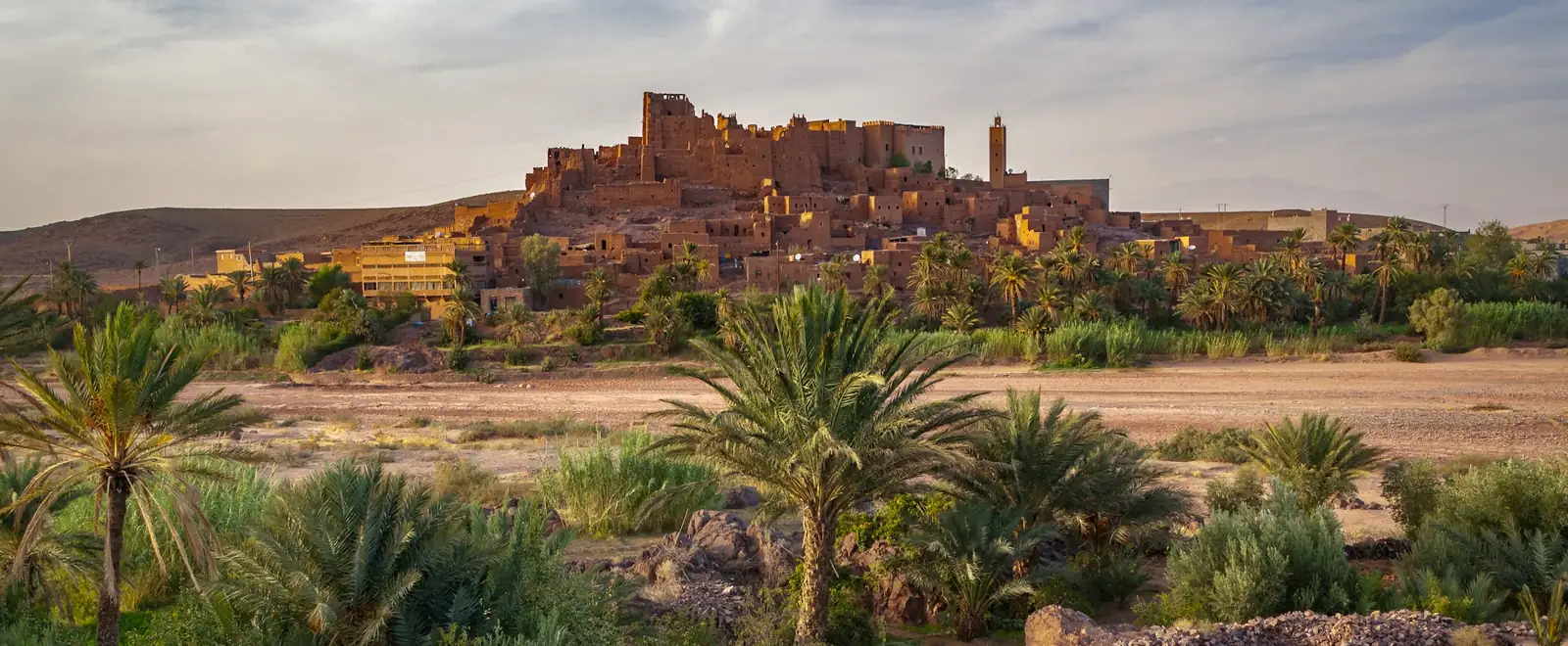
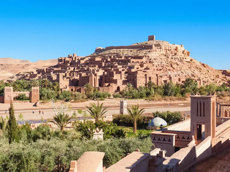
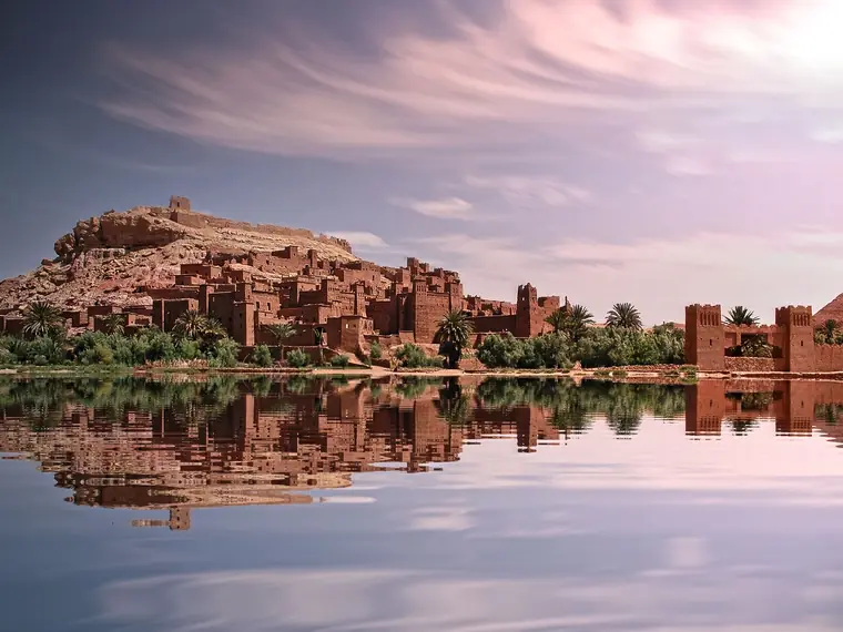
Seen from across the river, Aït Ben Haddou looks as though it has always been there, a hill of red earth shaped into towers and walls. In fact it is the product of a particular moment in history, when camel caravans carried gold and salt across the Sahara and every valley on their route grew rich by sheltering and taxing them. The story of this village is the story of that trade: how it began, what it built, why it ended, and how a place that was almost abandoned became one of the most admired monuments in Morocco. What follows is Ait Ben Haddou history in brief, from the first caravans to the present day.
01What the Name Means
In Tamazight, the Amazigh language, “Aït” means “the people of” or “the children of”. Aït Ben Haddou is therefore “the people of Ben Haddou”, the family or clan that, according to local tradition, founded or ruled the settlement. Oral history sometimes places this ancestor as far back as the time of the Almoravids, in the eleventh century, when the dynasty that founded Marrakech swept north from the Sahara along these same valleys.
A second word is needed. Aït Ben Haddou is a ksar (plural ksour), a fortified village in which many families live within a single defensive wall. A kasbah, strictly, is the fortified house of one powerful family. The ksar of Aït Ben Haddou contains several kasbahs, together with humbler houses and communal buildings, which is why the two terms are so often mixed up.
02The Caravan Route
For about a thousand years, from the early Middle Ages until the nineteenth century, the wealth of Morocco depended on trade across the Sahara. Caravans of hundreds, sometimes thousands, of camels left the markets of West Africa, above all Timbuktu, carrying gold, ivory, ostrich feathers and enslaved people. They returned with salt from the desert mines, cloth, copper, weapons and manufactured goods from the Mediterranean.
The journey across the desert took around fifty days. On the Moroccan side the caravans emerged at the oases of the Draa and the Tafilalet, then had to cross the High Atlas to reach Marrakech. One of the main routes followed the Draa north to what is now Ouarzazate, turned up the valley of the Ounila, and climbed to the pass of Telouet before descending to the plain.
Aït Ben Haddou stands exactly where that route leaves the open country and enters the mountains. It was a natural place to rest, to water animals in the river, to store goods, hire guides and pay for protection. A village that could offer security here was assured of prosperity.
03A City Built of Earth
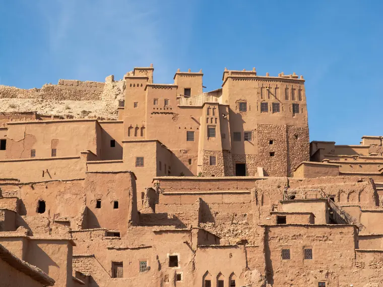
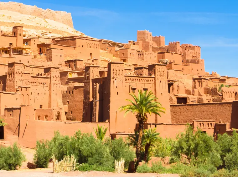
The ksar was built with the materials at hand. Foundations are of river stone. Walls are of pisé: damp earth mixed with gravel, shovelled between wooden boards and pounded until hard, then raised course by course. Upper storeys and decorative work are in adobe, sun-dried bricks of mud and straw, which are lighter and can be laid in patterns. Ceilings are of palm or tamarisk beams covered with reeds and a thick layer of earth.
Earth is a remarkable material in this climate. Thick walls stay cool through the heat of the day and give back warmth at night. But it has one enemy, water. Each rainstorm washes a little of a wall away, and every year after the rains the surfaces must be replastered with mud and straw. A building that is lived in is maintained. One that is left empty begins to dissolve within a few years.
This is why it is difficult to give precise dates to anything you see. The site has been occupied for many centuries, but the structures standing today are generally thought to date from the seventeenth century onwards, rebuilt again and again on older foundations in a style that has hardly changed.
An earthen village is never finished. It survives only as long as people keep repairing it.
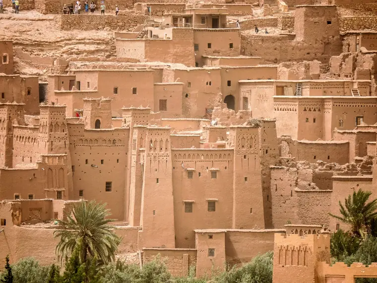
Mud, straw and wood…
04How the Ksar Worked
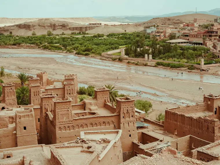
The layout expresses a society that had to defend itself and share scarce resources. The village climbs a steep hill, with the river as a moat on one side and a wall with corner towers around the rest. Entry was by a small number of gates that were closed at night. Inside, lanes are narrow and partly roofed over, easy to defend and shaded from the sun.
At the foot of the hill stand the great kasbahs of the leading families, tall houses with four corner towers whose upper parts are decorated with lozenges, chevrons and blind arches in raised mud brick. These motifs are thought to have had a protective as well as an ornamental purpose. Animals were stabled on the ground floor, stores kept above, and the family lived at the top, moving to the roof terrace on summer nights.
The community shared a mosque, a public square for assemblies and celebrations, threshing floors outside the walls, a caravanserai for travellers, and two cemeteries, one Muslim and one Jewish, for the village had a Jewish population of traders and craftsmen. At the very top stood the agadir, a fortified collective granary where each family kept grain and valuables, and which served as the last refuge in case of attack. Village affairs were managed by the jemaa, an assembly of the heads of families, which settled disputes and organised the sharing of water and the upkeep of walls and canals.
05The Lords of the Atlas
In the second half of the nineteenth century, power in this region passed to one family, the Glaoui, whose base was the kasbah of Telouet, at the head of the Ounila Valley beside the pass. According to a story often told, in the winter of 1893 they gave shelter to Sultan Moulay Hassan and his army, caught by snow on their way back from the south. In gratitude the sultan left them arms, including a cannon, which allowed them to subdue their rivals.
Within a generation the Glaoui controlled the passes of the High Atlas and much of the south. Under the French protectorate, established in 1912, Thami El Glaoui became pasha of Marrakech and one of the most powerful men in the country. The kasbahs of the Ounila, including those of Aït Ben Haddou, lay on the road between his mountain stronghold and his southern domains.
By then, however, the trade that had created the village was dying. European ships now carried the goods of West Africa by sea, colonial frontiers cut the desert routes, and the last great caravans dwindled away around the turn of the twentieth century.
06Decline and Departure
The decisive blow came with a road. In the 1930s the French built a motor road over the Tizi n’Tichka, a pass to the west of the old route. Traffic between Marrakech and the south no longer needed the Ounila Valley, and Aït Ben Haddou found itself on a quiet side track.
After independence in 1956, the Glaoui lands were confiscated and Telouet was abandoned. In the following decades the families of the ksar began to move across the river to a new village beside the road, where they could build in concrete and have electricity, running water, a school and access for vehicles. It was a reasonable choice. Carrying water up a hill and replastering walls every year is hard, and the river, which floods after rain, could cut the old village off for days.
By the 1970s and 1980s most of the houses in the ksar were empty, roofs had fallen and walls were melting back into the hillside. A way of building that had lasted a thousand years seemed about to disappear.
07Rescue: UNESCO and the Cinema
Two things saved Aït Ben Haddou. The first was recognition. In 1987 UNESCO inscribed the ksar on the World Heritage List as an outstanding example of the earthen architecture of southern Morocco. A Moroccan conservation body based in Ouarzazate was given the task of restoring it, using traditional materials and techniques and employing local builders who still knew them.
The second was film. Directors had discovered the site in the 1960s, when scenes for “Lawrence of Arabia” were shot in the region, and they kept coming back. “The Man Who Would Be King”, “The Jewel of the Nile”, “The Mummy”, “Gladiator” and, more recently, “Game of Thrones” all used the village as a setting. Productions brought work, paid for repairs and occasionally built additions: the lower gateway that many visitors assume to be ancient was constructed for a film.
Cinema also brought fame, and with fame came travellers. Tourism gave the villagers a reason to maintain their old houses, open them to visitors and sell crafts in the lanes.
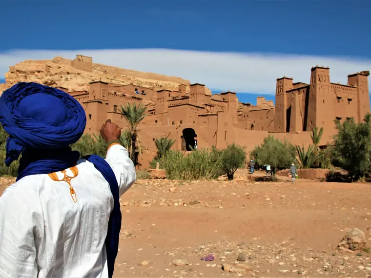
From caravans to cameras…
08The Village Today
Today only a handful of families live permanently inside the ksar, but it is far from dead. Houses have been restored as small museums, shops and tea terraces. A footbridge now links the two banks, so that the old village is no longer cut off when the river rises, although in the dry months you can still cross on stepping stones as the caravans’ guides did.
Conservation remains a constant labour. After every wet winter walls need attention, and the earthquake that struck the High Atlas in September 2023 caused cracks and some collapses, which have been the subject of repair work since. The challenge is to keep the place alive without turning it into a stage set: to keep people living and working there, using the same earth and the same skills.
When you climb to the granary at the top and look out, the logic of the site is still plain. To the south, the valley opens towards Ouarzazate and the desert. To the north, it narrows towards the mountains and the old pass. The caravans are gone, but the road they took is in front of you.
09Key Dates at a Glance
A brief timeline of the ksar.
- 11th centuryThe period to which oral tradition attributes the founding of the settlement
- 17th century onThe probable age of the oldest buildings standing today
- 1930sThe Tichka road opens and traffic leaves the Ounila Valley
- 1987Inscription on the UNESCO World Heritage List
10How to See the History for Yourself
A few things to look for when you visit:
- The view from the far bankBefore crossing, look at the whole ksar. You can read the defensive wall, the towers and the granary on the summit.
- The decorated towersStudy the patterns in mud brick on the upper parts of the kasbahs; each family had its own.
- A house interiorSeveral families open their homes for a small fee. You see the stable, the stores, the kitchen and the terrace.
- The granaryClimb to the top for the view and for a sense of how the village defended its food.
- The Ounila ValleyDrive north towards Telouet to follow the old caravan route through villages and gardens to the Glaoui kasbah.
- Go early or lateAt sunrise and in the last hour before sunset the earth glows and the lanes are quiet.
11Ait Ben Haddou History: Frequently Asked Questions
How old is Aït Ben Haddou?
The site has been inhabited for many centuries, and tradition dates it to the eleventh century. The buildings visible today are generally thought to date from the seventeenth century onwards.
Why was Aït Ben Haddou built there?
It stands on the old caravan route between the Sahara and Marrakech, where the road left the plain and entered the High Atlas. It offered shelter, water and protection to traders.
Do people still live in Aït Ben Haddou?
A few families still live inside the ksar. Most residents moved to the modern village across the river.
When did it become a UNESCO World Heritage Site?
In 1987.
What is the difference between a ksar and a kasbah?
A ksar is a fortified village of many families. A kasbah is the fortified house of a single important family. Aït Ben Haddou is a ksar that contains several kasbahs.
About the Author

We travel these roads all year and love sharing real stories, hidden gems and practical advice with you.
Visit Aït Ben Haddou on the Way to the Desert
- Over the Tichka pass
- Guided walk in the ksar
- On to the Dades and Merzouga
- Private vehicle and driver-guide
Related Articles
Explore more
Continue Your Journey
Turn what you have read into a real itinerary. Our local team will shape a private route around your dates, your interests and your pace.
Planning your trip? For official information about Morocco, visit Visit Morocco, the website of the Moroccan National Tourist Office.